


OIC is pleased to share our success in development of Simultaneous Localization and Mapping algorithm for Sidescan and Bathymetric data in GPS denied environments. For detailed information, please click here.
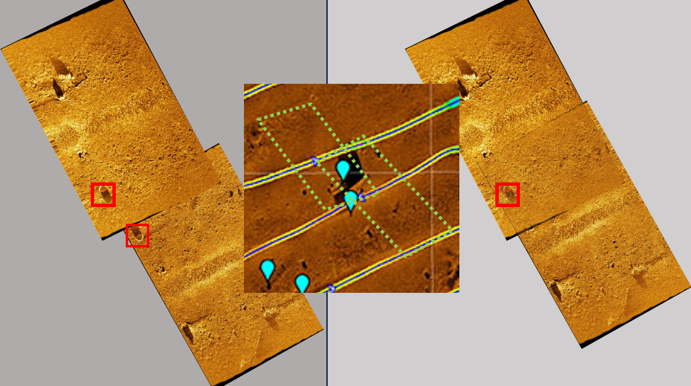
InterNAV in SAMM: Feature-based navigation tools!
Adjust trackline navigation by identifying and matching
features in overlapping swaths, or referencing to charted
features with known positions. This tool is ideally
suited for ROV surveys, or any time precise information
is not available. Click here for more information.


Many new formats added for 2025!
Contact Us for more information.
Garmin, *.RSD
Echologger DASS710 and MRS900, *.DASS *.MRS
Cerulean Sonar Omniscan 450FS and 450SS, *.SVLOG
Imagenex 881A-GS, *.81R
Marine Sonic Technologies, *.SDS
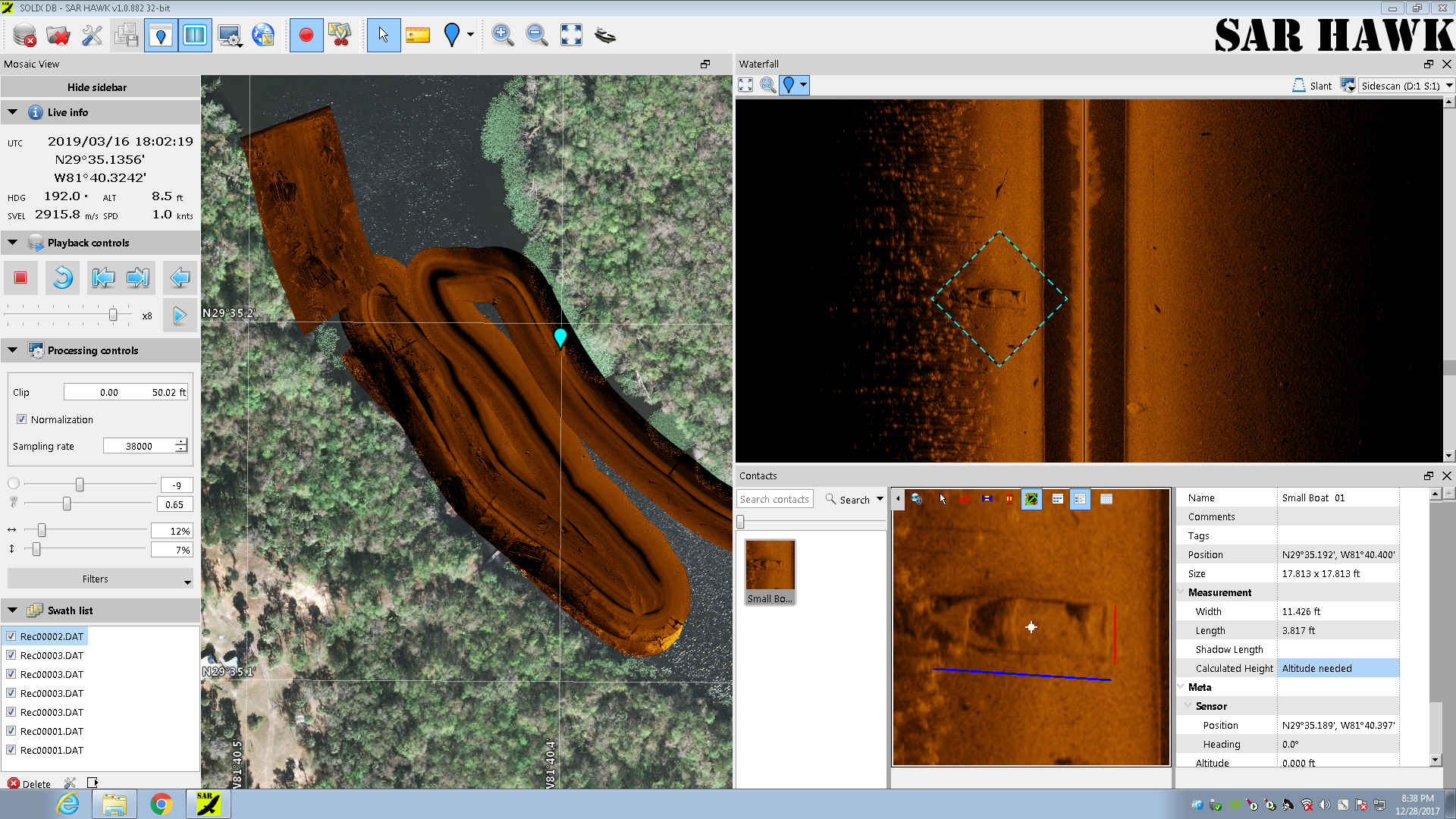
OIC is proud to announce SarHAWK. Our low-cost post processing software for humminbird sonars. Ideal for Search and Rescue, Police, Fire, Harbors, volunteer and recreational users!
Click here to learn more!
Oceanic Imaging Consultants, Inc. is the leading manufacturer in easy-to-use seafloor mapping software systems; our software systems are used by commercial, federal, military, and academic clients worldwide. OIC's software provides critical solutions to seafloor imaging problems. We are able to accomplish our client's goals by providing consistent high quality, easy-to-use, turnkey software as well as in-house expertise and excellent customer service.


