Introducing SAMM-PACK
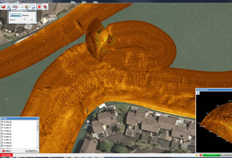
SAMM is our Stand Alone Mosaicking Module, ideal for underwater search and survey. SAMM-PACK bundles SAMM with a forward-look sonar, steerable pole-mount, GPS system and computer to give marine units an underwater search system that maps the searched area, shows areas covered on a map, chart or air-photo background, and allows target marking and image export.
You see where you have searched as you go, and know what you have to cover next. With GeoTIFF and Google-Earth exports, quantifiable reporting is a snap.

- Easy to Use Plug-and-Play Add-on to Your Forward Look Sonar
- Automatically Creates Mosaics in Real Time from Forward Look Sonar Data
- Automatically Loads Background Charts or Imagery for Easy Geo-Referencing
- Supports Post-Processing, Swath Layering, Imagery Enhancement and Export
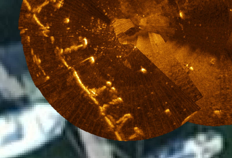
Supported Forward-Look Systems
| Gemini 720 series Starfish Sidescan |
|
| BlueView P/M series | |
 |
Kongsberg/Mesotech M3 |
| R2Sonic 2024 | |
| SoundMetrics Aris |
Data Acquisition Features:
- Stand-alone module, seamlessly compatible with your existing FLS system
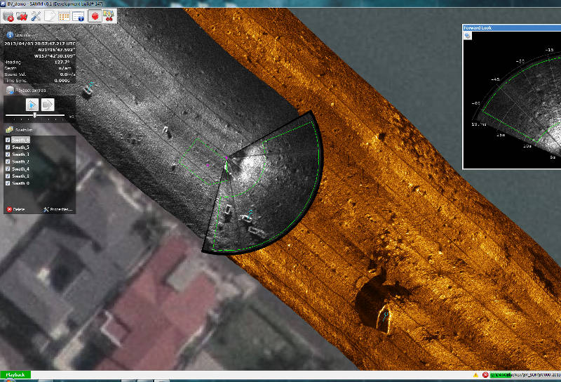
- Interactive control of track layering, processing and sensor offsets
- Simultaneous mosaicking and logging of broadcast data
- Pan, zoom, target marking and vessel track
Post-Acquisition Processing Features:
- Navigation and heading filtering
- Sensor/navigation offset and bias corrections
- Instant reprocessing and editing of recorded data
- Easy image export to GeoTIFF and Google Earth
- Per-track adjustment of contrast/gamma/brightness
- 16-bit imagery support for optimum image resolution
- Interactive image selection tools for cherry picking data
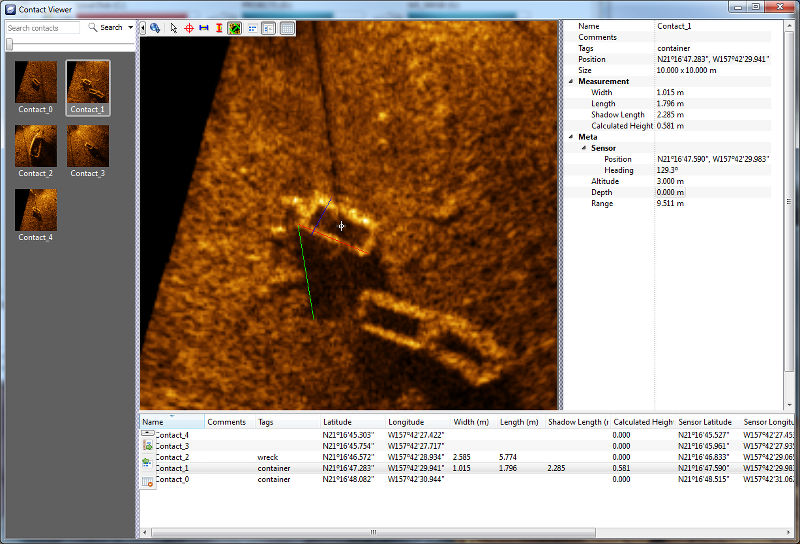
- Contact marking, measurement, classification and export
- Layering of individual tracks for optimal mosaic composition
- Background display of air photos, satellite imagery, raster and vector charts
Downloads
Please click on images below to download: